Shapefile import dialog
The map page has a button "Add a new field". Click it to open the dialog. Then select "Import a shapefile".
This enables you to import a Shapefile with field information. The fields will be added to the farm you select.
Shapefile requirements
Requirements:
- The shapefile should be a .zip file, that contains at least a a.shp file, .dbf file, and a .shx file.
- The encoding of the file should be UTF-8
- The shapefile needs to contain geographic coordinates (long - lat; WGS84; EPSG: 4326);
The shapefile may contain any of the following columns (Column names must be equal to the ones named below). This information will be used when creating fields, field geometries, and growing seasons.
FieldName: the name of the fieldCrop: The crop name must be one of the crop names known to FieldlookVariety: The variety name must belong to the crop, and be known to Fieldlook
You can download the following example: example-shapefile.zip
Field previews
The dialog shows previews of the fields that are to be imported.
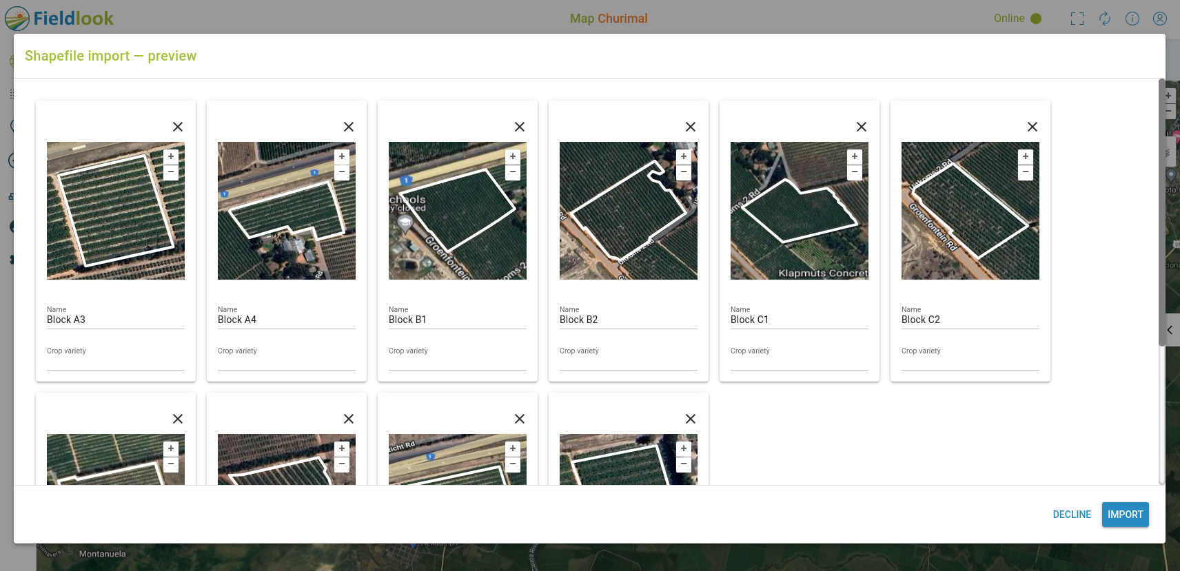
If the shapefile contains 30 fields or less, they are shown on a Google Maps background. More fields will get a grey background.
Check the field shapes, locations and names. Check the crop varieties if you added them.
You can modify the names and crops in this preview. You can remove any fields you don't need, by clicking the cross on the top-right of the preview.
Click "Variety" to open the variety picker.
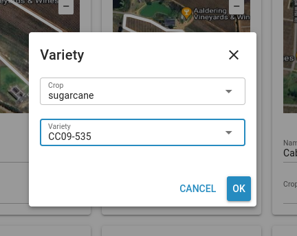
First select a crop. Then pick a variety of that crop. If the desired variety is not available, you can add it by just entering a new variety name and pressing "Enter".
If you're satisfied, click "Import" to start the import. Click "Cancel" to cancel the operation.
This will create the field, using the given name; the shape of the field; and a single growing season with the given crop variety, which starts on the current day, and has a duration of one year.